|
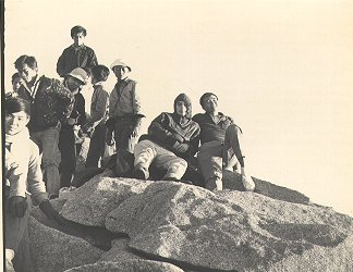
I and some schoolmates joined in the Mount Kinabalu expedition during our first term school holidays in April 1966.
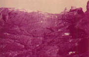
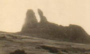
| Photo courtecy of Mr. Christopher Walton |
|
All
photos on this Mt. Kinabalu trip courtesy of Christopher Walton. Mount Kinabalu, Sabah.
During the first term school holiday in April 1966, Mr. Christopher Walton (a British
Volunteer for Service Overseas) organized an expedition to Mount Kinabalu. We were briefed by Mr. Walton on what to bring
along including whistle, small torchlight, nylon raincoat with zip type, sweater, jacket, gloves, canned food, biscuits, chocolates,
water and extra T-shirts for changing the inner sweat-wet one with the outer one when it becomes too cold for comfort. Nowadays,
climbers bring along instant noodles in their knapsacks both of which were unavailable in those days.
We started
on the 7th April morning from Beaufort by train to Tanjung Aru station, near Jesselton (now called Kota Kinabalu). From there,
two Land Rovers brought us to the Kinabalu National Park Headquarters to notify the Park Warden of our arrival which we had
reservation earlier by paying a deposit of M$10. We then proceeded by the same vehicles to a power station at 6000 feet above
sea level. Our two Kinabalu National Park guides joined us from there for the ascent by foot. One guide acted as the lead
of the file and the other guide at the last of the procession to make sure no one went astray. We started by walking up a
wooden staircase then continued on a jungle track, passed by a communicating and transmitting station on our way up to Carson
Hut at Layang-Layang (approximately, 8700 feet) to camp for the night. In 1966, all huts built for climbers were prefab aluminium
for walls and roofs with plank floors and glass louvre windows. Then, the next day we walked for two and a half hours to
the Panar Laban twin huts, elevation at 11,000 feet approximately, to rest and retire early for the next day's early morning
climb to the summit.
We were told to have an early start as cloud often obscured the view after 9.00 a.m. and a
return be made to the Park Headquarters before 11.00 a.m. if we wished to go back to Kota Kinabalu by road the same day or
else it would be too dark and dangerous. The narrow road was built at the side of the mountain hardly large enough for two
vehicles on some stretches. Going up and down the road was slow because the view ahead was short as it was built on mountain
sides.
On the third day, 9th April 1966, at around 2 a.m., we started to climb again. We were lucky to have the
Moon over head. Under the moonlit night, we could see the Sayat-Sayat aluminium hut at about 12,500 feet above sea level
which we later passed by it on our way to the summit (Low's Peak, 4095.2 metres above sea level). Arriving at Peak at around
4.30 a.m. we waited for the beautiful sunrise. I had a panoramic view up there and I saw the clouds were far below me in
a level formation. The sight of dawn was very profound from this vantage point. The first light of dawn was of immense beauty,
which had a great visual impact on me when I first observed the first break of dawn at the peak. It is quite the opposite
of observing it from sea level where the clouds are above the horizon. The fantastic impression cannot be forgotten easily.
It stays in my mind for years to come.
Even now I have a feeling of nostalgia whenever I think of the majestic
Mount Kinabalu or see it in picture. The climb was arduous in my time (1966) as compared to nowadays but worth it and a rewarding
one as well.
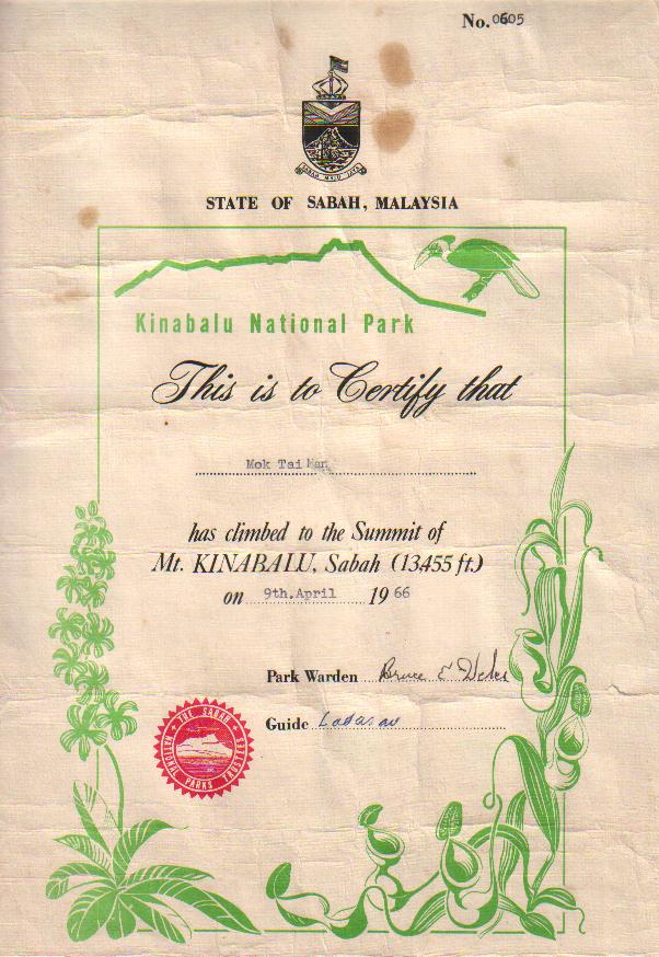
After we had taken some pictures we commenced the journey down which took only about 7 hours to reach
the Kinabalu National Park Headquarters at around noon. At the Park Headquarters, we each paid M$1 (now is called one ringgit
Malaysia) for a memorable souvenir copy of the official certificate confirming our climb.
Mount Kinabalu had an average
of 30,000 climbers annually since the late 1990s to 2000.
Sir Hugh Low was the first to climb to the summit of Mount
Kinabalu on 11th March 1851. He is now famous because of his feat and the research he made during his expedition and its
surrounding areas, especially Low's Gully. Low's Gully and Low's Peak were named after him. The former height of the mountain
(13,455 feet or 4101 meters) was calculated by him, which was very near to today's measurement.
Kinabalu National
Park is centred on the 4,095.2 metre Mount Kinabalu, the highest mountain in South East Asia. This new height was obtained
using Global Positioning System.
When World Heritage Committee of the Paris-based United Nations Education, Scientific
and Cultural Organization (Unesco) met on 30th November 2000, Kinabalu National Park and Mulu National Park in Sarawak were
qualified for the honour of being listed in World Heritage Sites. These two sites are Malaysia's first to qualify. They
were among the 61 new sites added to the list, which now totals 691 sites in 122 countries for Year 2000.
Kinabalu
National Park met two of four criteria whereas the Mulu National Park met all four criteria as based on the convention concerning
the Protection of the World Cultural and Natural Heritage adopted by Unesco in 1972.
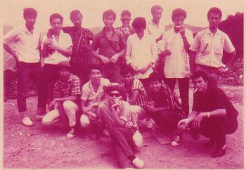
| Photo courtecy of Mr. Christopher Walton |
|
I am on the right sitting with Mr. Christopher Walton. On the left, front is John Wong and Robert Linggi is behind him.
| Photo courtecy of Mr. Christopher Walton |
|
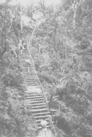
The first start on foot up the wooden staircase.
|